
DESCRIPTION EAST - WEST
Route: Dom na Kofcah – Jelendol – Dovžanova soteska – Tržič – Podljubelj – Ljubelj – Planinski dom na Zelenici
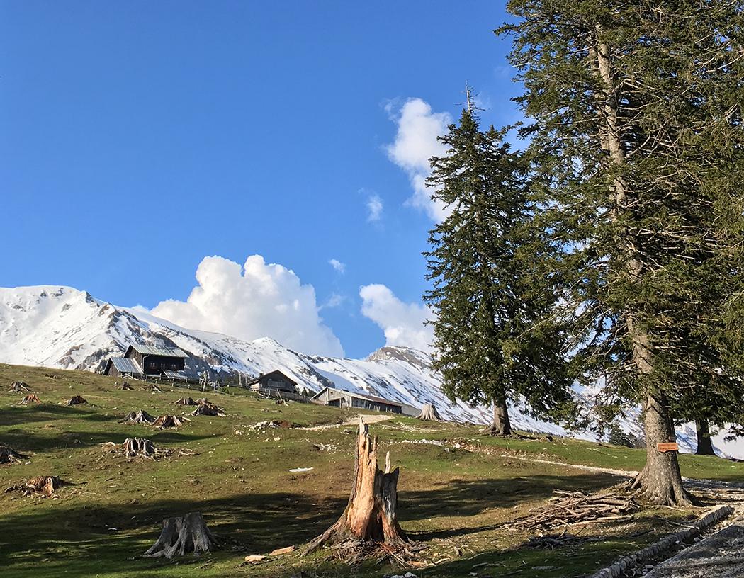
Start: Dom na Kofcah (elevation 1.488 m)
Destination: Planinski dom na Zelenici (elevation 1.534 m)
From Dom na Kofcah we descend towards Tržič by road (don’t ride over the meadows!) through the gate towards Ravni. We ride carefully, as we often meet hikers in this area, the road is steep and full of big rocks. When we reach the end of this steep road and reach the junction at Ravni, we choose the leftmost road and continue along the pleasant gravel road, turning left again after 200 m. We continue straight past the junction for Kal, the road will begin to descend again after two kilometers towards Jelendol village. At the intersection of two roads, we turn right and continue downhill, another 4 kilometers to Jelendol. Above the village the gravel turns into asphalt, but the road in the gorge remains steep and narrow. In Jelendol we reach the valley of Tržiška Bistrica, we recommend a short stop at the crossroads below Born Manor where we can read how this valley was advanced at the turn of the 19th and 20th centuries on the information boards.
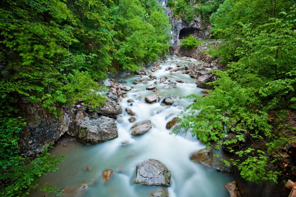
Continue right towards the village of Dolina, where the last part of the descent to Tržič begins. The road is wider but also busier. A stopover is quite essential in the Dovžan Gorge, a 300 million-year-old natural monument where fossil remains can be found at every turn and the geological past learned about.
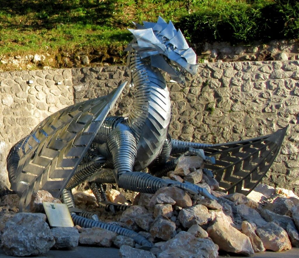
Only a few minutes down the road remain to Tržič. We can refresh ourselves in the city, take a tour of the Kurnik House along the way, learn about the local history at the museum and take a picture in front of the famous dragon, which illustrates the story of the place’s origin.
At the main bus station, we turn right towards Podljubelj. We slowly start climbing through the town center – the whole ascent to our destination Zelenica will be a good 12 kilometers, and we will climb more than 1,000 meters. We follow the signposts to Podljubelj – when we come from the town center, we follow the road right up, when the road goes down to the Mošenik river after 2 kilometers and crosses it, we go left up to the overpass across the main road and then immediately right again. We follow this road through Podljubelj. If we did not refresh ourselves in Tržič, there are some good local inns along the way. At the end of the village there is a junction where you can choose an alternative route across the Preval mountain and Begunje towards the Valavasor’s hut (left across the main road), while the basic variant of the Trans Karvanke MTB Trail continues on the right side of the main road past the abandoned hotel. Here the asphalt turns into a worse gravel road, we followed it for one kilometer up the valley. Before the left turn on our road we turn onto the main Ljubelj road. In the next two kilometers we drive very carefully at the side of the road, as the road is very busy!
As we climb, we will see a large monument behind the parking lot on the road on the right, and on the left there are remains of the Ljubelj camp, a branch of the infamous Mauthausen concentration camp from the 2nd World War. Prisoners of war built the present tunnel on Ljubelj in horrible conditions.
Before the tunnel we turn left into the parking lot and after 200 m we cross the bridge. A steep gravel road branches off to the right, and this is the last of the ascent to Zelenica. Due to the poor road and steep slope we will probably hike along the bike for quite a few sections. The road climbs through the forest to the valley where the ski slope used to be, but nowdays the area is very popular for ski touring in the winter. Under the mighty scree and walls of Begunjščica we reach the middle station of the former cable car, where the road turns sharply to the right and then climbs to the top on the right side of the valley. Under the saddle with the upper station of the cable car, we already feel that the destination is nearby – and indeed, right below the saddle, the Zelenica Mountain Lodge awaits us.
Caution! During the summer months, livestock grazes on the plains of the Karavanke mountains, so we must close the gates behind us and do not disturb animals with aggressive riding.
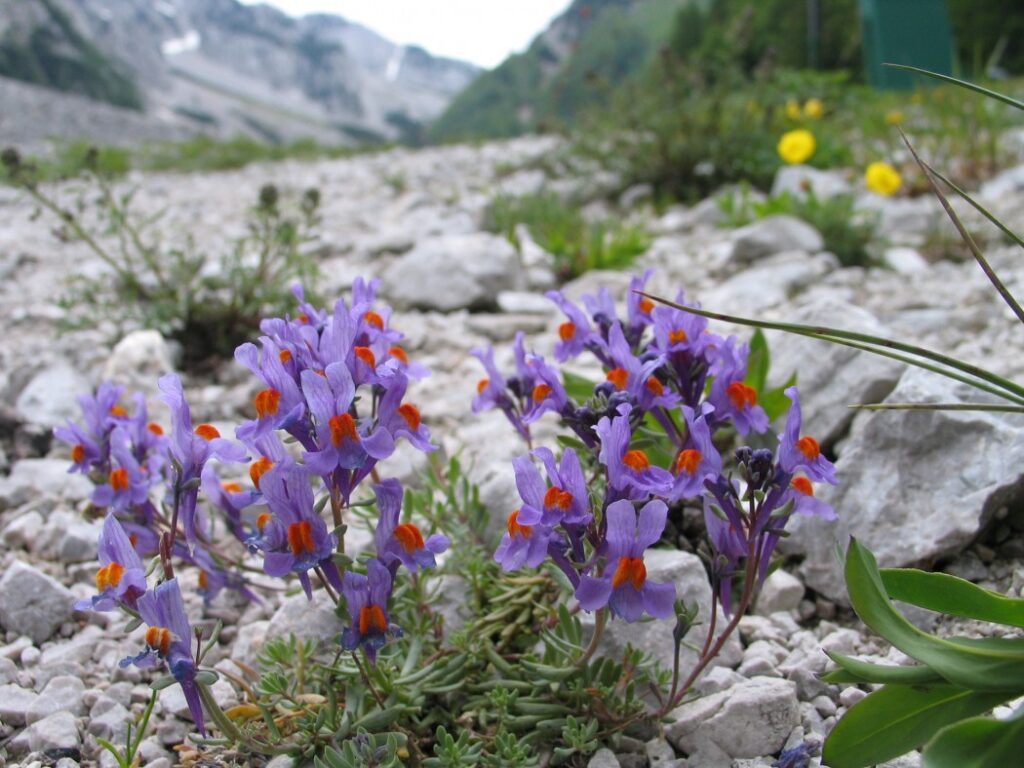
Sights along the route:
DESCRIPTION WEST - EAST
Route: Planinski dom na Zelenici – Ljubelj – Podljubelj – Tržič – Dovžanova
soteska – Jelendol – Dom na Kofcah
Start: Planinski dom na Zelenici (elevation 1.534 m)
Destination: Dom na Kofcah (elevation 1.488 m)
We leave the mountain lodge at Zelenica in the direction of Ljubelj along the road which leads over the saddle under the upper station of the former cable car. We make a turn along the ski slope under the mighty scree and walls of Begunjščica, then the road sticks to the left side of the valley. The gravel is very rough and the road is steep, so we have to be really careful when descending. At the middle lift station, we again reach the ski slope, turn left and follow a shorter, gentler section. Before arriving at the parking lot at Ljubelj, the road turns rigth into the forest and becomes steep again.
At Ljubelj, we turn left to the main road, then continue right along it. For two kilometers we drive very carefully along the side of the road, as the road is very busy!
As we descend, we will see a large monument behind the parking lot on the road on the left, and on the right there are remains of the Ljubelj camp, a branch of the infamous Mauthausen concentration camp from the 2nd World War. Prisoners of war built the present tunnel on Ljubelj in horrible conditions.
The parking lot next to the camp and the Karavla Inn is followed by a long right turn, then a slight left turn. After the second one we will watch for two junctions with the gravel roads – the first road comes from above, followed by a shorter concrete fence, we focus on the second gravel road, which will lead us along the main road away from traffic down the valley. We soon reach the asphalt – the parking lot of a larger building that used to be a hotel once. We continue straight on the side road that will lead us across the meadow and then through the village Podljubelj towards Tržič. At the overpass and exit for the campsite follow the road straight, and follow that road all the way through the village of Podljubelj. We will cross the main road again at the overpass. After the end of the village we descend a good kilometer, still following the road that turns left over the overpass. From here it is another two and a half kilometers to the center of Tržič.
We can refresh ourselves in the city, take a tour of the Kurnik House along the way, learn about the local history at the museum and take a picture in front of the famous dragon, which illustrates the story of the place’s origin.
At the main bus station, we turn left and start climbing towards Kofce. The goal of today’s stage is still 13.5 kilometers and just under 1,000 meters of ascent. Through the villages of Slap and Dolina we will reach the picturesque Dovžan Gorge, a 300 million-year-old natural landmark, where fossil remains can be found at every turn and we can learn about the geological past.
The ascent continues to the village of Dolina, followed by an easier section towards Jelendol village. In Jelendol we recommend a short stop at the crossroads below Born Manor, where we can read how this valley was advanced at the turn of the 19th and 20th centuries on the information boards. Turn left at the crossroads and the steep ascent in the gorge of the Dolžanka stream begins. The asphalt road soon turns into a gravel road, which also means less traffic. Four kilometers from Jelendol is the crossroads where we turn left towards Kofce. We follow this road, at the junction for Kal we follow the upper (right) road, and also turn onto the right road at Ravni. When the road ends, there are four forest roads and a hiking trail waiting for us at the crossroads. We head right up the forest road towards Kofce. The last part of the route is relatively steep, fortunately it is only a bit more than one kilometer long. In some places, we may need to get off the bike because of the steepness and the loose ground. The slope does not loosen even when we enter the mountain pasture through the wooden gate. We follow the cart track on the mountain and do not ride on the grass! A stone’s throw away we can already see the Kofce mountain hut on the grassy slopes of Košuta, where today’s stage finishes.
Caution! During the summer months, livestock grazes on the plains of the Karavanke mountains, so we must close the gates behind us and do not disturb animals with aggressive riding.
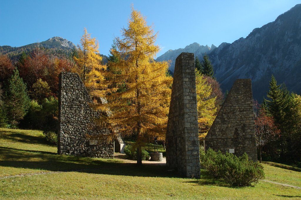
Sights along the route:
- Dovžan Gorge (Dovžanova soteska)
- Dragon of Tržič (Tržiški zmaj)
- Tržič – the old town centre
- Tržič Museum (Tržiški muzej)
- Ljubelj Labour Camp (Taborišče Ljubelj)
c

