e1. Zgornje Jezersko – Dom na Kofcah

IMPORTANT! Due to environmental restrictions, use of the section from road in Komatevra towards Brsna lesa is only permitted from 1 July to 30 November! Outside this period the Trans Karavanke tour starts / ends in Medvodje.

DESCRIPTION EAST-WEST

Route: Zg. Jezersko – Sp. Jezersko – Komatevra – Brsna lesa – Medvodje – Planina Šija – Dom na Kofcah

Start: TIC Jezersko, Zgornje Jezersko 57, 4206 Zgornje Jezersko (altitude 860 m)

End: Dom na Kofcah, (altitude 1.488 m)

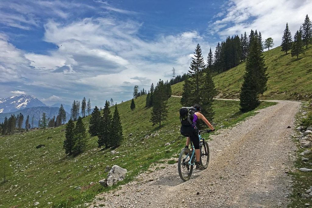
The starting point of the Trans Karavanke MTB Trail is in Zgornje Jezersko. At the Tourist Information Center (TIC Jezersko) we will find the first checkpoint with a stamp, then head along the main road towards the Kokra Valley.

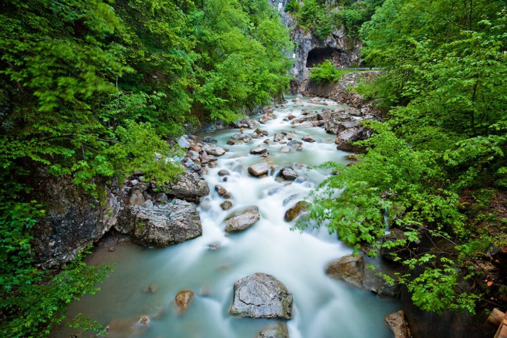
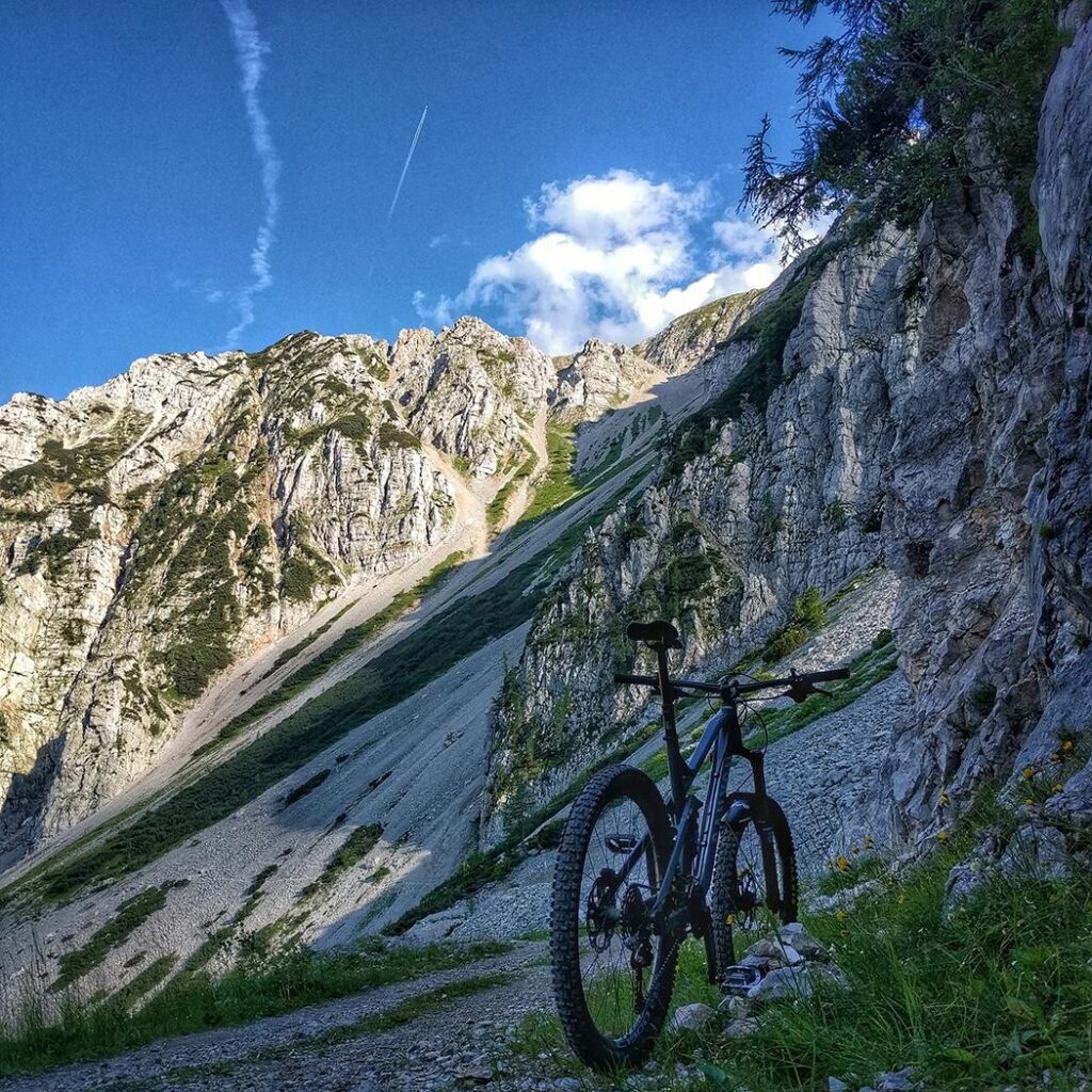
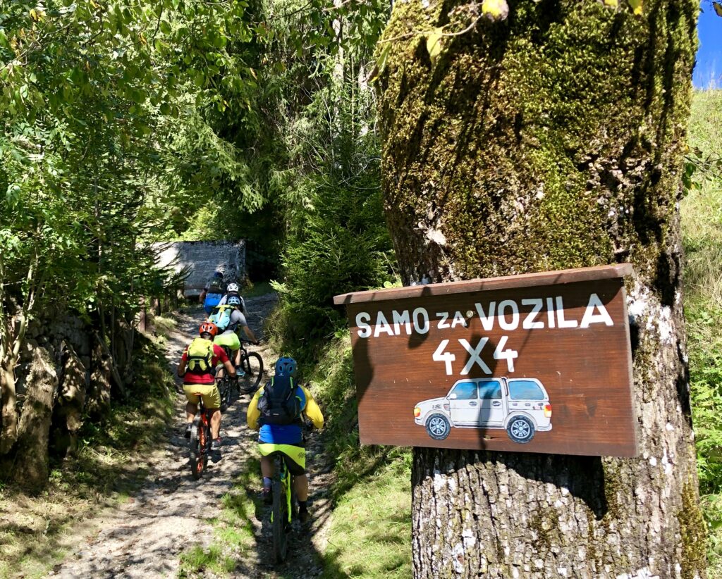
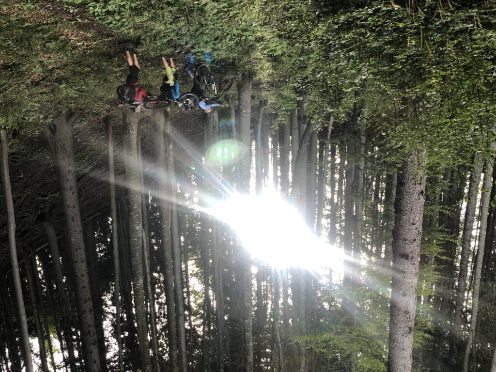
At the end of the village, we turn left onto a side road, following which we continue our journey towards Spodnje Jezersko. Our shortcut will cross the main road (carefully!) and rejoin it for a short time, but already at the first houses in Spodnje Jezero, turn right across the bridge towards Pečovnik and Komatevra. An ascent of about 7.4 km begins and with a height difference of 750 meters. In the lower part we follow the ascent along the river Kokra, the asphalt behind the settlement of Bajte soon turns into a gravel forest road. We will pass by the old quarry, higher we can see the partisan hospital Krtina along the way. At the last right turn, under the remains of the Pečovnik barracks, turn onto the path that leads left up towards Brsna wood. (If you came to the end of the road and to the ruins of the former border barracks of Pečovnik, you went about 300 m too far. Go back to the last sharper bend.) This is followed by a shorter, more difficult section (about 500 m) where some steeper sections may need to be walked by the bike.

At Brsna lesa, the climb is completed – when we reach the saddle on the Tržič side, we descend to the gravel road, turn left and follow the road and signposts down towards Medvodje. At the sharp right bend, we follow the main road to the right, at the junction with the road to Brsnina planina left, above Bukov Hill at the intersection of four roads again to the right and at the next intersection below Bukov Hill straight down. When we reach the valley of Tržiška Bistrica, we turn left towards Medvodje, which leads to a good kilometer of easy descent.

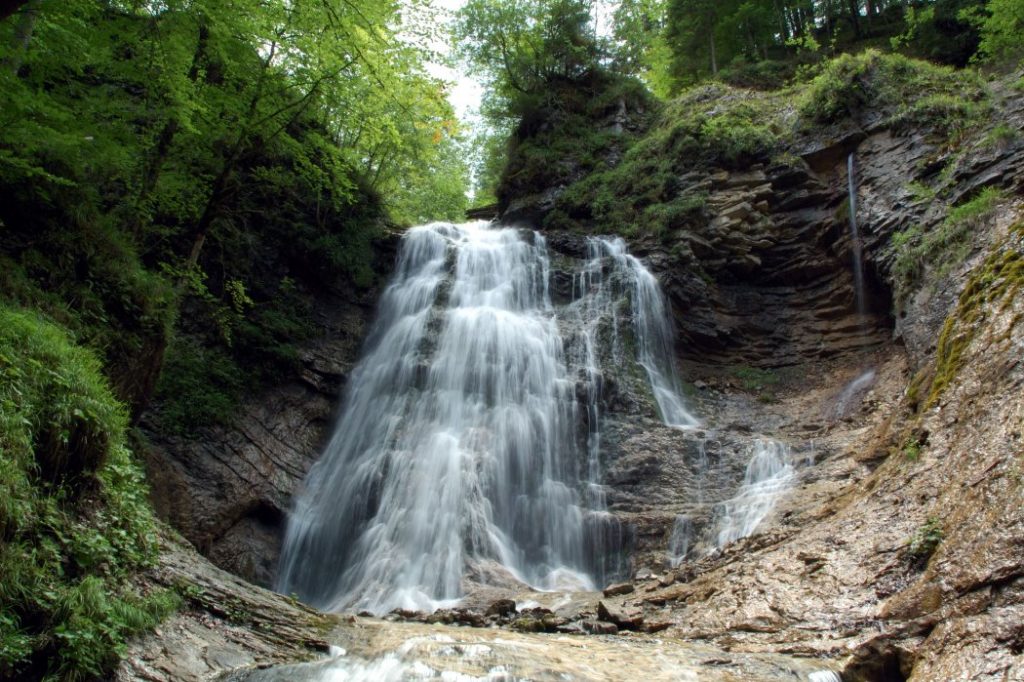
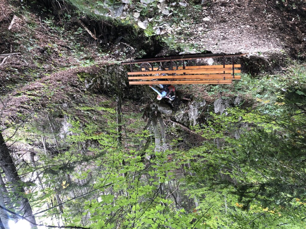
Below the houses and in front of the main intersection in Medvodje, there is a sharp left turn leading to Stegovnik Waterfall – although the waterfall lies 1 km away from our path, it is worth climbing up to it and seeing it.

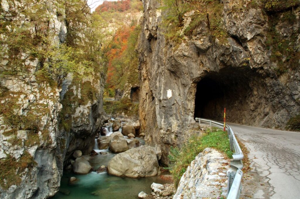
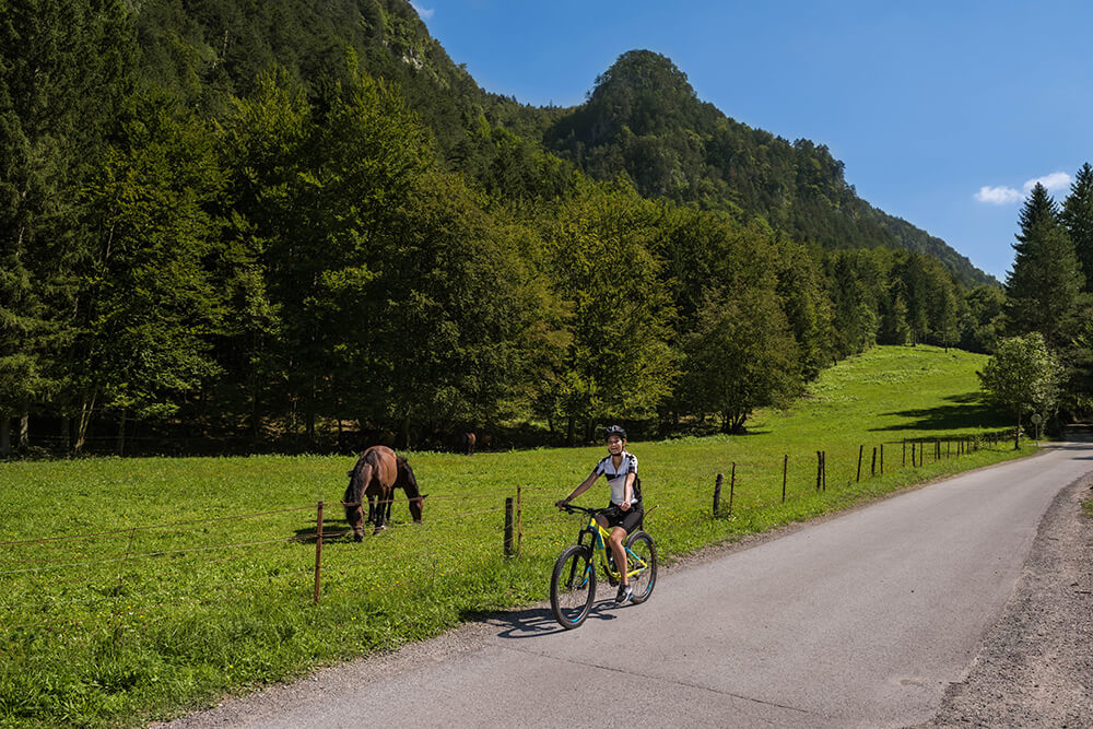
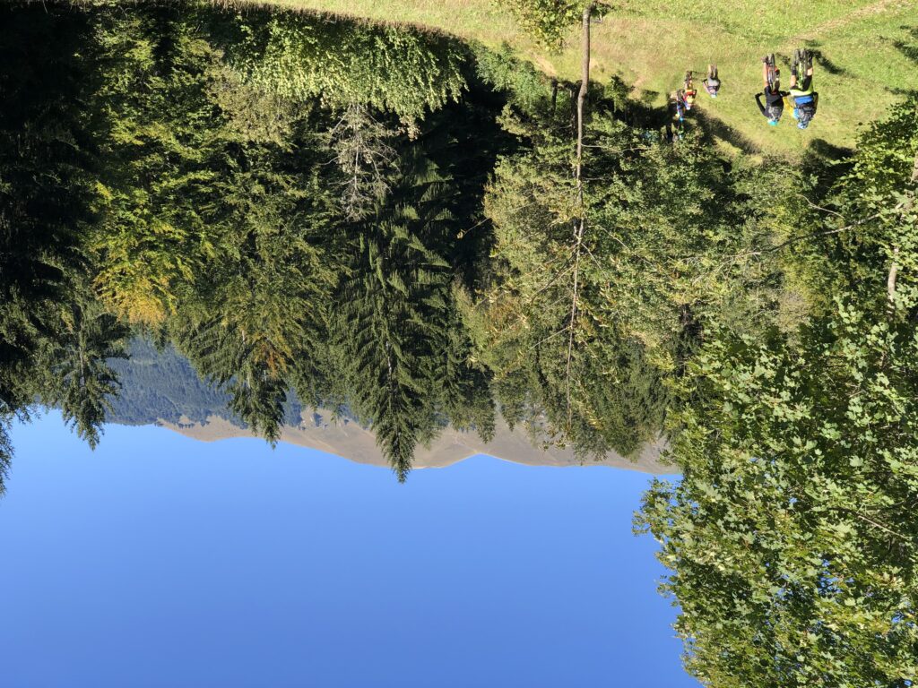
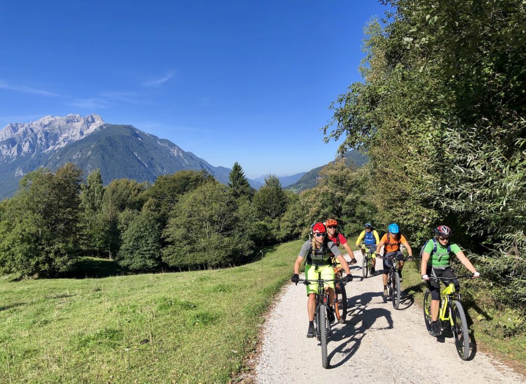
At the crossroad in Medvodje, in case of bad weather or lack of time, we have the option of descending the road through the Dovžan Gorge to Tržič. Otherwise, we turn right and start another ascent at this stage – it is 13.5 km long, and together we will climb another 850 altitude meters along the slopes of Košuta to the finish line on Kofce.

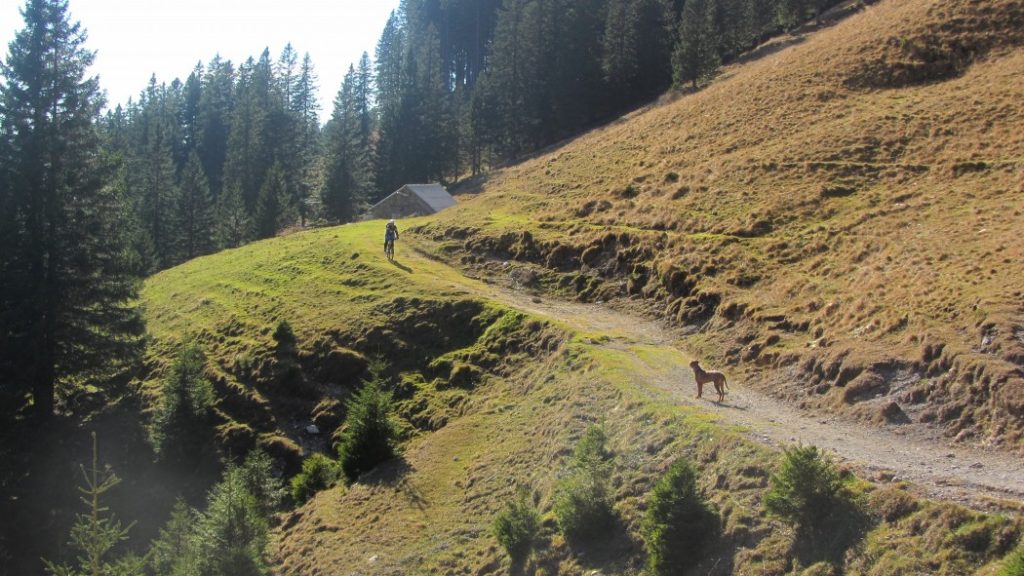
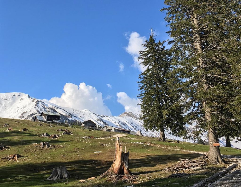
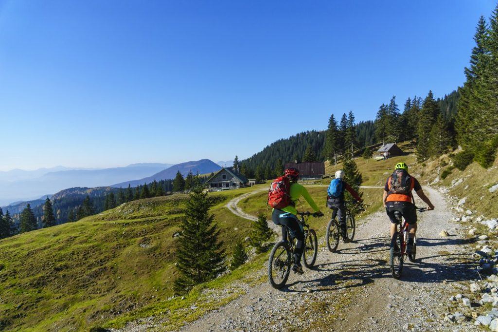
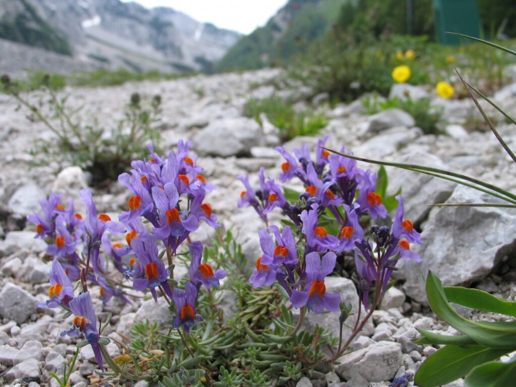
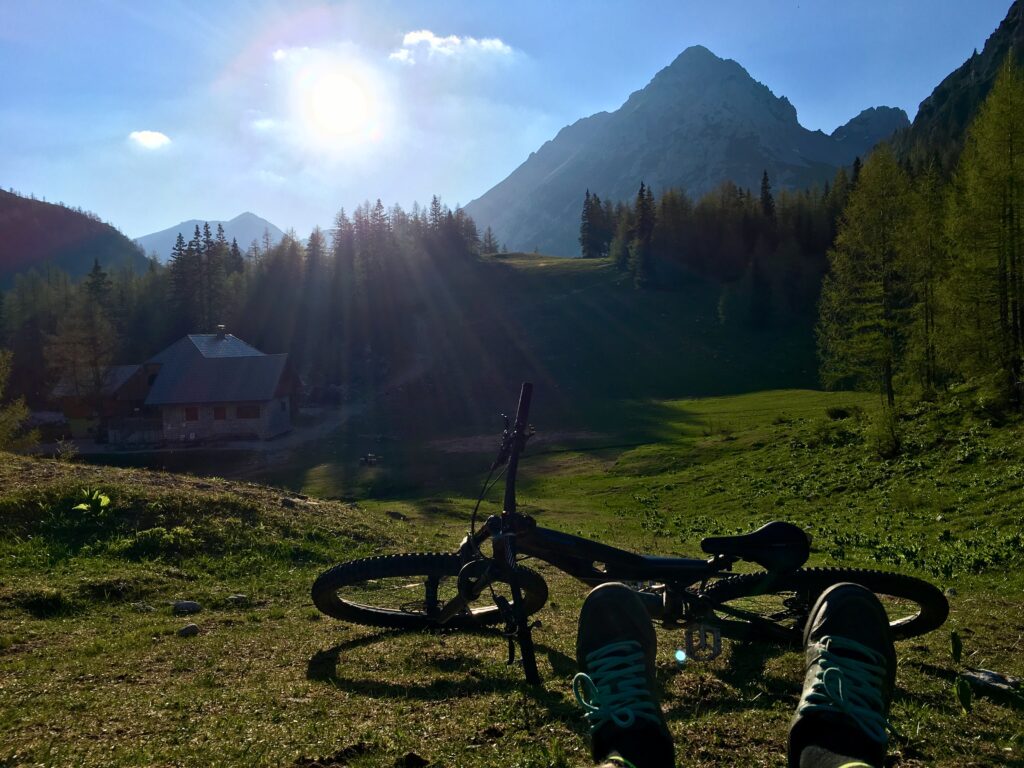
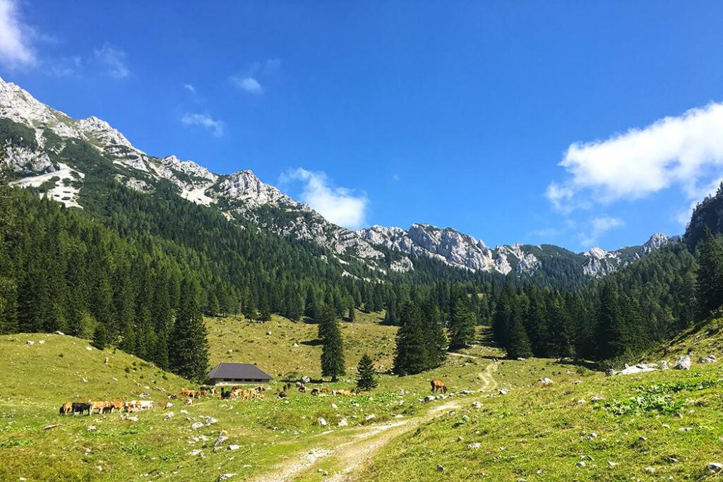
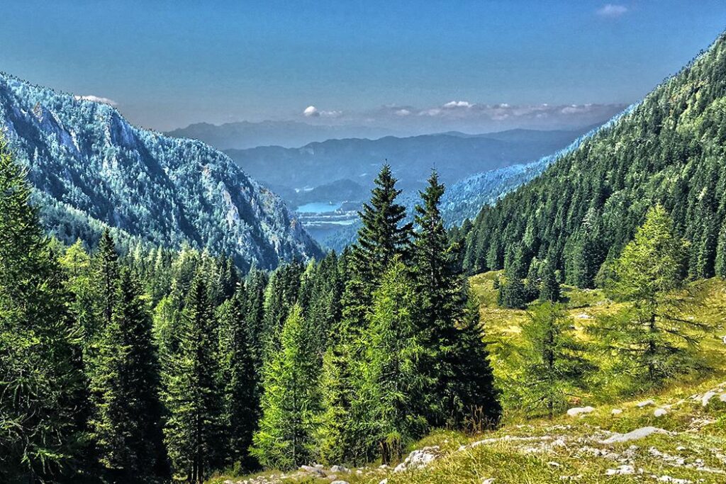
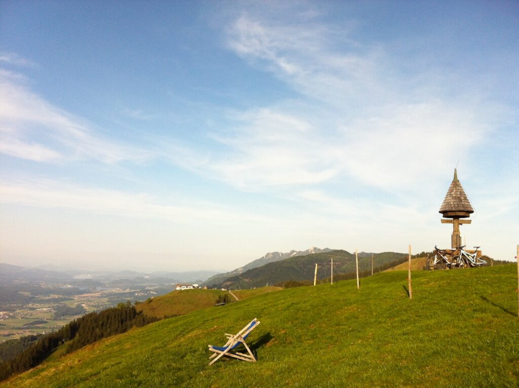
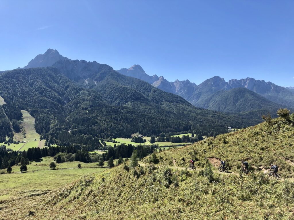
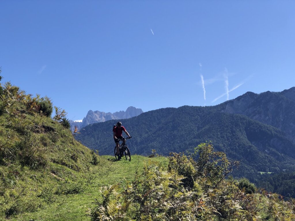
The second part of the trail also mostly leads along well maintained forest roads. We first ascend the by stream of Košutnik. At the intersection at the smaller building, we turn left towards Šija. After a shorter flat part, a steep ascent and then a pleasant, sometimes flat, part of the road through the woods to the junction for Pungrat and Šija. Turn right here, and at the following crossroads follow the signs for Šija or Pungrat. After a kilometer and a half, we will reach the picturesque Pungrat Mountain Pasture, where in the summer we can enjoy home-made dairy delicacies. We have already climbed above the forest border, so we can enjoy the beautiful views. As we continue towards Šija on the road, we soon reach the highest point of the day (1,555 m), a stop with good refreshment can also be enjoyed at the Šija Hut (Taborniški dom Šija). The last part of the route follows the trail that leads from the Šija mountain pasture past the Ilovica mountain towards the finish of the stage – Dom na Kofcah. On the short but steep road to the mountain hut we can check if we have any energy left after a long day.

DESCRIPTION WEST-EAST

Route: Dom na Kofcah – Planina Šija – Medvodje – Brsna lesa – Komatevra – Sp. Jezersko – Zg. Jezersko

Start: Dom na Kofcah, (altitude 1.488 m)

End: TIC Jezersko, Zgornje Jezersko 57, 4206 Zgornje Jezersko (altitude 860 m)

From the Kofce Mountain Hut we descend on the road (we do not ride over the meadows!), but after 150 meters we turn sharply left onto the trail towards Šija mountain. We climb the picturesque Ilovica mountain to the Šija hut (Taborniški dom Šija), it may be necessary to step off the bike on a steeper part. From the hut, there is less than a kilometer uphill to the highest point of the day (1,555 m). The descent follows, the road winds down the slopes of Košuta. We do not rush too much, but rather enjoy the views beyond the forest border and follow the main road. After that we come to a crossroads, where we turn sharply left in the direction of Medvodje. This is followed by a slightly more varied road – some descents, flat sections and shorter climbs. At Košutnik, we turn right, climb slightly further, then go down all the way to Medvodje. This is where we turn left. In front of the houses, there is a smaller road to the right leading to Stegovnik Waterfall (Stegovniški slap) – although the waterfall lies 1 km away from our path, it is worth climbing to it and seeing it.

The ascent to Brsna lesa (8 km, 750 m height difference) follows. From Medvodje, we ride through the valley of Tržiška Bistrica, turn right at the crossroads. We climb past Bukov hrib, turn left at the intersection of four roads above it. After one kilometer we turn right, then follow the road and enjoy the views of Košuta. When the slope slows evens out a little, we slowly approach Brsna lesa saddle, and when we reach it, we branch off to the right. Only about 20 m we follow the trail leading up the meadow by the road, on the right we will see the path towards the saddle, which we follow to the Jezersko side. (The trail continues up the ridge.) Immediately across the saddle, we go straight at the intersection of the two paths, followed by a shorter, more demanding section of the dynamic path. After about 500 meters it leads us again to the gravel road below Pečovnik.

Down the road we descend into the valley, at the rare intersections we choose the main road leading to the valley. In Komatevra we can see the partisan hospital Krtina, a little lower we will drive through the old quarry. But the descent quickly passes and in Spodnje Jezersko we join the busy main road. We turn left towards Zgornje Jezersko.

The last climb is less than two kilometers long, and we will rise just over 100 meters in height. Immediately after the first serpentine turn left onto the shortcut, cross the main road once (carefully!) And continue on the gravel road. Higher, when we are already among the first houses, for a short time we join the main road and continue right to the destination. The last checkpoint with the stamp is at the Tourist Information Center (TIC Jezersko), where the Trans Karavanke MTB Trail ends. But if you have at least a bit of energy, drive to Planšarsko Lake and enjoy a well-deserved refreshment!

Caution! During the summer months, livestock grazes on the plains of the Karavanke mountains, so we must close the fences behind us and do not disturb animals with aggressive riding.

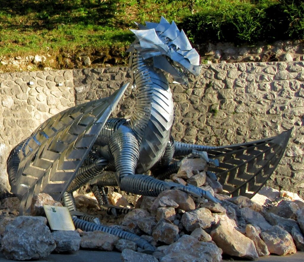
Sights along the way:

e2. Dom na Kofcah – Planinski dom na Zelenici

DESCRIPTION EAST - WEST

Route: Dom na Kofcah – Jelendol – Dovžanova soteska – Tržič – Podljubelj – Ljubelj – Planinski dom na Zelenici

Start: Dom na Kofcah (elevation 1.488 m)

Destination: Planinski dom na Zelenici (elevation 1.534 m)

From Dom na Kofcah we descend towards Tržič by road (don’t ride over the meadows!) through the gate towards Ravni. We ride carefully, as we often meet hikers in this area, the road is steep and full of big rocks. When we reach the end of this steep road and reach the junction at Ravni, we choose the leftmost road and continue along the pleasant gravel road, turning left again after 200 m. We continue straight past the junction for Kal, the road will begin to descend again after two kilometers towards Jelendol village. At the intersection of two roads, we turn right and continue downhill, another 4 kilometers to Jelendol. Above the village the gravel turns into asphalt, but the road in the gorge remains steep and narrow. In Jelendol we reach the valley of Tržiška Bistrica, we recommend a short stop at the crossroads below Born Manor where we can read how this valley was advanced at the turn of the 19th and 20th centuries on the information boards.

Continue right towards the village of Dolina, where the last part of the descent to Tržič begins. The road is wider but also busier. A stopover is quite essential in the Dovžan Gorge, a 300 million-year-old natural monument where fossil remains can be found at every turn and the geological past learned about.

Only a few minutes down the road remain to Tržič. We can refresh ourselves in the city, take a tour of the Kurnik House along the way, learn about the local history at the museum and take a picture in front of the famous dragon, which illustrates the story of the place’s origin.

At the main bus station, we turn right towards Podljubelj. We slowly start climbing through the town center – the whole ascent to our destination Zelenica will be a good 12 kilometers, and we will climb more than 1,000 meters. We follow the signposts to Podljubelj – when we come from the town center, we follow the road right up, when the road goes down to the Mošenik river after 2 kilometers and crosses it, we go left up to the overpass across the main road and then immediately right again. We follow this road through Podljubelj. If we did not refresh ourselves in Tržič, there are some good local inns along the way. At the end of the village there is a junction where you can choose an alternative route across the Preval mountain and Begunje towards the Valavasor’s hut (left across the main road), while the basic variant of the Trans Karvanke MTB Trail continues on the right side of the main road past the abandoned hotel. Here the asphalt turns into a worse gravel road, we followed it for one kilometer up the valley. Before the left turn on our road we turn onto the main Ljubelj road. In the next two kilometers we drive very carefully at the side of the road, as the road is very busy! 

As we climb, we will see a large monument behind the parking lot on the road on the right, and on the left there are remains of the Ljubelj camp, a branch of the infamous Mauthausen concentration camp from the 2nd World War. Prisoners of war built the present tunnel on Ljubelj in horrible conditions.

Before the tunnel we turn left into the parking lot and after 200 m we cross the bridge. A steep gravel road branches off to the right, and this is the last of the ascent to Zelenica. Due to the poor road and steep slope we will probably hike along the bike for quite a few sections. The road climbs through the forest to the valley where the ski slope used to be, but nowdays the area is very popular for ski touring in the winter. Under the mighty scree and walls of Begunjščica we reach the middle station of the former cable car, where the road turns sharply to the right and then climbs to the top on the right side of the valley. Under the saddle with the upper station of the cable car, we already feel that the destination is nearby – and indeed, right below the saddle, the Zelenica Mountain Lodge awaits us.

Caution! During the summer months, livestock grazes on the plains of the Karavanke mountains, so we must close the gates behind us and do not disturb animals with aggressive riding.

Sights along the route:

DESCRIPTION WEST - EAST

Route: Planinski dom na Zelenici – Ljubelj – Podljubelj – Tržič – Dovžanova
soteska – Jelendol – Dom na Kofcah

Start: Planinski dom na Zelenici (elevation 1.534 m)

Destination: Dom na Kofcah (elevation 1.488 m)

We leave the mountain lodge at Zelenica in the direction of Ljubelj along the road which leads over the saddle under the upper station of the former cable car. We make a turn along the ski slope under the mighty scree and walls of Begunjščica, then the road sticks to the left side of the valley. The gravel is very rough and the road is steep, so we have to be really careful when descending. At the middle lift station, we again reach the ski slope, turn left and follow a shorter, gentler section. Before arriving at the parking lot at Ljubelj, the road turns rigth into the forest and becomes steep again.

At Ljubelj, we turn left to the main road, then continue right along it. For two kilometers we drive very carefully along the side of the road, as the road is very busy! 

As we descend, we will see a large monument behind the parking lot on the road on the left, and on the right there are remains of the Ljubelj camp, a branch of the infamous Mauthausen concentration camp from the 2nd World War. Prisoners of war built the present tunnel on Ljubelj in horrible conditions.

The parking lot next to the camp and the Karavla Inn is followed by a long right turn, then a slight left turn. After the second one we will watch for two junctions with the gravel roads – the first road comes from above, followed by a shorter concrete fence, we focus on the second gravel road, which will lead us along the main road away from traffic down the valley. We soon reach the asphalt – the parking lot of a larger building that used to be a hotel once. We continue straight on the side road that will lead us across the meadow and then through the village Podljubelj towards Tržič. At the overpass and exit for the campsite follow the road straight, and follow that road all the way through the village of Podljubelj. We will cross the main road again at the overpass. After the end of the village we descend a good kilometer, still following the road that turns left over the overpass. From here it is another two and a half kilometers to the center of Tržič.

We can refresh ourselves in the city, take a tour of the Kurnik House along the way, learn about the local history at the museum and take a picture in front of the famous dragon, which illustrates the story of the place’s origin.

At the main bus station, we turn left and start climbing towards Kofce. The goal of today’s stage is still 13.5 kilometers and just under 1,000 meters of ascent. Through the villages of Slap and Dolina we will reach the picturesque Dovžan Gorge, a 300 million-year-old natural landmark, where fossil remains can be found at every turn and we can learn about the geological past.

The ascent continues to the village of Dolina, followed by an easier section towards Jelendol village. In Jelendol we recommend a short stop at the crossroads below Born Manor, where we can read how this valley was advanced at the turn of the 19th and 20th centuries on the information boards. Turn left at the crossroads and the steep ascent in the gorge of the Dolžanka stream begins. The asphalt road soon turns into a gravel road, which also means less traffic. Four kilometers from Jelendol is the crossroads where we turn left towards Kofce. We follow this road, at the junction for Kal we follow the upper (right) road, and also turn onto the right road at Ravni. When the road ends, there are four forest roads and a hiking trail waiting for us at the crossroads. We head right up the forest road towards Kofce. The last part of the route is relatively steep, fortunately it is only a bit more than one kilometer long. In some places, we may need to get off the bike because of the steepness and the loose ground. The slope does not loosen even when we enter the mountain pasture through the wooden gate. We follow the cart track on the mountain and do not ride on the grass! A stone’s throw away we can already see the Kofce mountain hut on the grassy slopes of Košuta, where today’s stage finishes.

Caution! During the summer months, livestock grazes on the plains of the Karavanke mountains, so we must close the gates behind us and do not disturb animals with aggressive riding.

Sights along the route:

c

e3. Planinski dom na Zelenici – Valvasorjev dom

DESCRIPTION EAST-WEST

Route: Planinski dom na Zelenici – Koča pri izviru Završnice – Smokuška planina – Tinčkova koča – Završniško jezero – Zabreška planina – Žirovniška planina – Valvasorjev dom

Start: Planinski dom na Zelenici, (altitude 1.534 m)

Destination: Valvasorjev dom (altitude 1.181 m)

The stage begins with a short climb from the Mountain Lodge at Zelenica (Planinski dom na Zelenici) towards the hut at the spring of Završnica (Koča pri izviru Završnice). The trail soon begins to descend, and at the spring of Završnica there is a short technically very demanding section where we hike along the bike. There is a checkpoint at the hut at the spring of Završnica, and we can also refresh ourselves before continuing. In the shelter of the mighty Begunjščica and Vrtača mountains, we continue for two kilometers on a steep forest road with a rather rough gravel through Smokuška Planina towards Tinčkova koča. This is where the road improves significantly and the slope becomes less steep. The descent continues for a little under 6 km past the mountain pasture Pri žagi and straight at the fork for Kališča. All too soon as we get to Završniško Lake, where the descent ends.

After the relaxing pause at the lake it is time to climb. At the crossroads behind the lake, we turn right towards Stol. We will climb for about 600 vertical meters, and to our destination – Valvasor’s Lodge – we will take a slightly longer route through the beautiful panoramic mountain meadows on the slope of the Stol mountain.

During the ascent, we can visit the Turkish Cave, where in the 15th and 16th centuries the inhabitants hid from the Turks. Access by bike is not possible, the cave is 5 minute hike away from the road.

At the Jamov’c intersection we turn right, continue for 1.4 km, then we turn left towards Zabreška planina. The road is steep, fortunately the dense forest protects us from the sun. After 1.5 km we are rewarded with one of the most beautiful views from the Gorenjska mountains: the Zabreška planina meadow offers a view of the many villages and towns below us, while the Julian Alps boast in the distance above Bled lake. The cabin also offers a great opportunity for refreshment after a long climb.

We continue cycling past Žirovniška planina. When we reach the gravel road after 1.5 km, we will turn right uphill, and only after a short 200 meters we will reach today’s destination, the Valvasor Lodge under Stol (Valvasorjev dom pod Stolom).

DESCRIPTION WEST-EAST

Route: Valvasorjev dom – Žirovniška planina – Zabreška planina – Završniško jezero – Tinčkova koča – Smokuška planina – Koča pri izviru Završnice – Planinski dom na Zelenici

Start: Valvasorjev dom (višina 1.181 m)

Destination: Planinski dom na Zelenici, (višina 1.534 m)

We descend for 200 meters on the main gravel road down from the Valvasor’s Lodge (Valvasorjev dom pod Stolom). On a right-hand bend, we turn left onto a side road towards Žirovniška planina and Zabreška planina. Stol, the highest peak of the Karavanke mountains, boasts over 1,000 meters higher. Passing Žirovniška planina after 1.5 km we reach Zabreška planina, where we are rewarded with one of the most beautiful views from the mountains of Gorenjska: the view opens to the valley and many places below us, and in the distance the Julian Alps boast above Bled.  

Shortly after Zabreška planina, the road begins to descend into the Završnica valley. After just under three kilometers, at the Jamov’c intersection, we connect to the main road, turn left anc continue downhill.

During the descent we can visit the Turkish Cave, where in the 15th and 16th centuries the inhabitants hid from the Turks. Access by bike is not possible, the cave is 5 minute hike away from the road.

Our descent will soon be completed – we will arrive in the valley of Završnica river. We turn left towards Završniško Lake. Today’s stage is not long, so we can take the time to stop.

The harder part of today’s route awaits us, the ascent to the Mountain Lodge on Zelenica. In eight kilometers we will climb just under 1,000 meters of altitude. The road leads up the valley, the asphalt soon turns into gravel, only steep sections are paved with concrete. We keep left at the junction for Kališče, cross the meadows Pri žagi, and after six kilometers of ascent we reach Tinčkova hut.

From here through Smokuška planina towards the hut at the spring of Završnica we have to cover a bit less than two kilometers of very steep road with rough gravel. For the most part it’s easier to walk and push the bike and enjoy the views of Begunjščica and Vrtača mountains that surround us.

There is a checkpoint with a stamp in the cabin at the spring of Završnica, and there is also a good time for a snack. We have an short, technically demanding part of the trail right at the spring of the Završnica – we pass this walking by the bike, remember to look back, as you can see all the way through the valley to Bled Lake and onwards to the Julian Alps. We will soon arrive at the former Zelenica ski area, the road becomes more gentle, with only a short descent from the summit to the Alpine Lodge at Zelenica.

Caution! During the summer months, livestock grazes on the plains of the Karavanke mountains, so we must close the gates behind us and do not disturb animals with aggressive riding.

Sights along the route:

  • The source of Završnica river (izvir Završnice)
  • Završniško lake
  • Turška cave
  • Zabreška planina

e4. Valvasorjev dom pod Stolom – Mojstrana

DESCRIPTION EAST-WEST

Route: Valvasorjev dom – Potoška planina – Olipova planina – Javorniški Rovt – Dom Pristava – Križovec – Planina pod Golico – Plavški Rovt – Dovje – Mojstrana

Start: Valvasorjev dom (altitude 1.181)

Destination: Slovenski planinski muzej Mojstrana (altitude 643 m)

We will warm up with an initial ascent from Valvasor’s hut towards Potoška planina, 1.5 km away and 100 vertical meters higher than the starting point. From here, continue for 1.5 km straight past the junction to Planina Stamare towards Olipova planina. We are paying attention to the path that branches off to the left from the gravel road – we will descend towards Javorniški Rovt. The descent is 2.5 km long and very steep, as we descend for 400 altitude meters. It contains some technically challenging sections where we recommend hiking for safety reasons.

At Javorniški Rovt, on the main asphalt road, we turn right towards the Pristava Lodge / Dom Pristava, which is 1.3 km away and 100 vertical meters higher. We stamp the logbook here, this is also a nice opportunity for lunch.

From the Pristava Lodge in Javorniški Rovt, three kilometers and nearly 300 meters of climbing towards Križovec will follow. We ride back to the main road and turn right. After 300 m we turn right again onto the gravel road, after 2.2 km at the crossroads to the left, followed by another 500 m to Križovec, where the ascent ends.

At the intersection of four roads, we continue straight towards Planina pod Golico. After 1 km we turn left and continue downhill, the gravel road will turn into asphalt and after another 2.5 km we will reach Planina pod Golico. At the crossroads, we turn right towards the church, and continue downhill below the church at the crossroads to the left, and a little further we continue straight. A shorter steep section (300 m) leads to the junction where we turn right across the bridge. Shortly after the start of the ascent we turn left again, then left again after the Tršan farm. This is followed by a kilometer of scenic path through the woods and across the meadows towards Plavški Rovt, where, if the route is planned at the right time, daffodils will accompany us.

At Plavški Rovt turn right uphill, as the last serious climb of the stage awaits. Along the well-maintained gravel roads, we will ascend 350 meters in five kilometers. We follow the main road and turn left at the Zakamnik farm. The climb is over at Visoke meadows, we can take a rest and enjoy the peace of a remote meadows. Another 7.5 km of gentle descent past the junction for Dovška Rožca and we are already in Dovje, and only a kilometer from here through the village and across the busy main road to Mojstrana. When crossing the main road do not overlook the monument to Jakob Aljaž, the pastor, music composer and a mountaineer who, among other things, is responsible for the erection of the tower at the top of Triglav, the highest Slovenian mountain. The stage ends in Mojstrana village at the Slovenian Alpine Museum.

DESCRIPTION WEST-EAST

Route: Mojstrana – Dovje – Plavški Rovt – Planina pod Golico – Križovec – Dom Pristava – Javorniški Rovt – Olipova planina – Potoška planina – Valvasorjev dom

Start: Slovenski planinski muzej Mojstrana (altitude 643 m)

Destination: Valvasorjev dom (altitude 1.181 m)

From Mojstrana we head across the Sava Dolinka river towards the village Dovje. When crossing the busy main road, don’t overlook the monument to Jakob Aljaž, the pastor, music composer and a mountaineer who, among other things, is responsible for the erection of the tower at the top of Triglav, the highest Slovenian mountain.

At Dovje, turn right and then follow the road through the village. Today’s first ascent is 7.5 km long and climbs just under 600 vertical meters. At the junction for Dovška Rožca continue straight. The ascent ends in Rogarjev Rovt where we can relax and enjoy the tranquility of a remote mountain meadows. Five kilometers long descent towards Plavški Rovt follows. Turn right at the Zakamnik farm, otherwise follow the main road.

In Plavški Rovt we pay attention to the signs, because in the middle of the village we have to turn left onto a picturesque path that will take us across the meadows and through the forests towards Planina pod Golico. If we are lucky, daffodils will follow us throughout this section. After a kilometer we reach the Tršan farm and continue down to the bridge over the Jesenica stream.

The second ascent of the stage begins in Planina pod Golico. It is four kilometers long and we will climb about 350 meters. Turn left after the bridge, and the climb starts with a short very steep section. We reach the church, continue right up and turn left at the chapel on the main road. At the end of the village, the asphalt turns into a gravel road that winds its way up the valley. After about three kilometers, turn right at the crossroads, another kilometer awaits us to Križovec – the intersection of four roads where the ascent ends.

At the descent after 500 m, turn right, continue 2.2 km towards Javorniški Rovt, where we connect to the asphalt road. After 300 m we turn left towards the Pristava Lodge / Dom Pristava in Javorniški Rovt. We stamp the log and refresh ourselves before the difficult finish of the stage.

From Dom Pristava, we descend back to the main road and continue downhill for another 1.3 km and 100 vertical meters.

We turn left from the main road, onto the road that leads towards the Trilobit Lodge, but after 50 meters turn right and cross the bridge. We follow a beautiful path through the forest which later turns into a very steep trail and then a forest path. In the direction of Olipova planina we have a demanding section, 2.5 km long, where we will ascend for as much as 400 meters. Much of the trail can not be ridden here because of the slope or the challenging surface, we suggest hiking along the bike.

Under Olipova planina our path joins the gravel road again. Follow it in the direction of Potoška planina which we will reach in 1.5 km. Keep left here, there are 1.5 km to the finish at Valvasor’s Hut / Valvasorjev dom pod Stolom. The last part will pass quickly as the road is mostly descending.

Caution! During the summer months, livestock grazes on the plains of the Karavanke mountains, so we must close the gates behind us and do not disturb animals with aggressive riding.

Sights along the route:

e5. Mojstrana – Korensko sedlo

DESCRIPTION EAST-WEST

Route: Mojstrana – Gozd Martuljek – Kranjska Gora – Rateče – Peč (Tromeja) – Korensko sedlo

Start: Slovenski planinski muzej Mojstrana (altitude 643 m)

Destination: Korensko sedlo (altitude 1.070 m)

Today’s stage has two faces: the first part leads us leisurely through the tourist besieged towns of the Upper Sava Valley, and the second part takes us along the lonely forest roads to the highest point of the day where the borders of the three countries – Slovenia, Austria, Italy – meet.

From the museum, we descend for 500 m through Mojstrana along the Triglavska Street and turn left onto Jakob Aljaž Street. After 250 m we turn right onto a smaller path and an avenue that leads to the bridge over the Sava Dolinka river. We turn left here. The navigation challenges are over for a while, as the well-maintained and marked D2 cycling route will take us up to Rateče village which is 19 km away and 220 vertical meters higher. We pass Belca and through Gozd Martuljek. If we like the hustle and bustle of downtown Kranjska Gora, we can also refresh ourselves there, otherwise we continue below the famous ski slopes and bike park towards Podkoren, past Zelenci, the source of Sava Dolinka river, to Rateče. At the roundabout we cross the main road and after 200 m turn left through the village. At the well in the middle of the village we can get some fresh water, and at the end of the village we branch off to the side road that leads up towards Tromeja. The climb is 6.5 km long with an altitude difference of 600 m. The asphalt soon turns into a gravel road, along the way we are accompanied by information boards where we can learn more about landscapes and activities in mountain pastures and forests above Rateče.

At the intersection after 2 km we continue left upwards, also going left past the fork for Dom na Tromeji which is unfortunately closed. Another turn follows, we also go left up here. Soon we will see meadows on the right, which are part of the ski resort on the Austrian side, and the last couple of switchbacks bring us right to the top. The peak offers a magnificent view of the Julian Alps to the south and the Ziljska valley (Gailtal), Dobrač and Carinthian lakes to the north. You have the unique opportunity to stand on the border point of three countries – Slovenia, Austria and Italy.

The tour ends with a descent to Korensko sedlo. We ride back on the road where we climbed, at the intersection after 2.5 km we turn sharp left. The gravel road is mostly descending for another 5 km until a kilometer before the finish it connects to the main road. We turn sharply left towards Korensko Sedlo, where we can congratulate ourselves as we completed the Trans Karavanke MTB Trail!

DESCRIPTION WEST-EAST

Route: Korensko sedlo – Peč (Tromeja) – Rateče – Kranjska Gora – Gozd Martuljek – Mojstrana

Start: Korensko sedlo (altitude 1.070 m)

Destination: Slovenski planinski muzej Mojstrana (altitude 643 m)

We begin our journey through the Karavanke mountain range at the Korensko sedlo border crossing. On the busy main road, we descend for one kilometer towards Rateče, then turn sharply right and we are already on a gravel road. The ascent is not too demanding, in the next seven kilometers we will climb for 400 meters, but it is true that the road also includes some short downhill sections. After five kilometers you should not miss the sharp right uphill turn followed by another 2.5 kilometers to the peak. Soon we will see meadows on the right, which are part of the ski resort on the Austrian side, and the last couple of switchbacks bring us right to the top of Peč, where borders of three countries (Slovenia, Austria, Italy) meet. The peak offers a magnificent view of the Julian Alps on the southern side and the Ziljska valley (Gailtal), Dobrač and Carinthian lakes to the North.

We will descend on the same road for 2.5 km, this time turn right at the crossroads and continue downhill towards Rateče. We pass the junction for Dom na Tromeji which is unfortunately closed. The whole descent is 6.5 km long, above Rateče we come from the woods to pastures and slowly descend into the village. Along the way we are accompanied by information boards where we can learn more about the landscape and activities in the pastures and forests above Rateče.

There are some good pubs in Rateče where we can refresh ourselves, fresh water can be found at the well in the middle of the village.

If the first part of the stage was on the lonely forest roads, the second will be its opposite – we came to the popular tourist area of the Upper Sava Valley, where the hustle and bustle of the road to Mojstrana is difficult to avoid. There will also be less navigation dilemmas, following the marked D2 cycle path for 19 kilometers to our destination. We ride through Rateče towards the east and at the end of the village turn right towards the main road. At the roundabout we cross the main road and head along the cycle path that takes us to the old railway line. If we have enough time we can turn to Planica Nordic Ski Center here, which is only two kilometers away. Otherwise, we turn left towards Kranjska Gora. We will cycle past Zelenci, the spring of the Sava Dolinka River, and through Podkoren. Under the bike park and famous ski slopes we reach Kranjska Gora. We continue along the D2 cycle path through Gozd Martuljek and past Belca. When we reach Mojstrana we turn right across the bridge over the Sava Dolinka River, through the avenue towards Jakob Aljaž Street and then some 250 m to the right onto the main Triglav Street. The destination of today’s stage is 500 meters away at the Slovenian Alpine Museum.

Caution! During the summer months, livestock grazes on the plains of the Karavanke mountains, so we must close the gates behind us and do not disturb animals with aggressive riding.

Sights along the route: